Mexico City◇2. The Valley

Let’s play! Today, we will explore the geography around Mexico City through paintings.

Quest #1: Visit the Museo Nacional de Arte (Free on Sundays) in Mexico City in search of any of the paintings below.

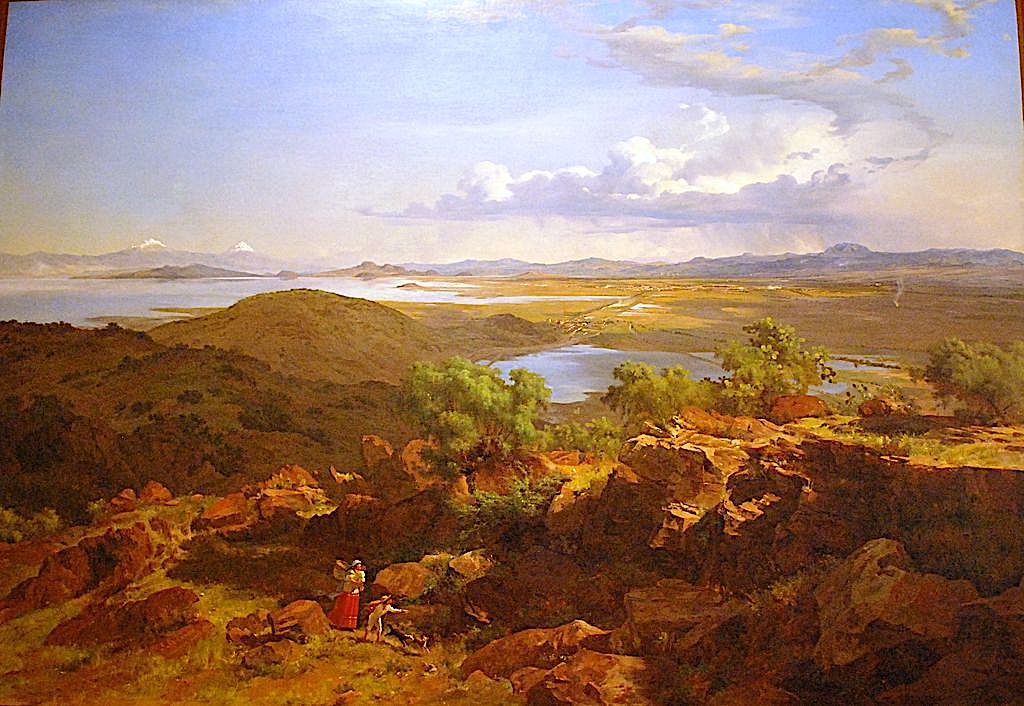
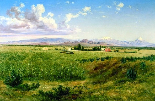
Well, Mexico City is located in the Valley of Mexico. To imagine the valley before its degradation with today’s urban development, enjoy three paintings by the famous Mexican artist José María Velasco, depicting the valley from more than 150 years ago.

Valley of Mexico by José María Velasco, via Wikipedia Commons

Completely surrounded by mountains, the valley used to collect its waters in five now-extinct lakes dotted with countless islands.

The white peaks that predominate paintings vistas are the Iztaccíhuatl (White Woman) and Popocatépetl (Smoking Mountain) volcanos.

In Aztec mythology, Iztaccíhuatl was a princess who fell in love with one of her father’s warriors, Popocatépetl. Noticing his daughter’s affection, emperor sends the warrior on a suicidal mission with his daughter hand in marriage as a reward. After receiving grave news about Popocatépetl death, Iztaccíhuatl dies of grief. When Popocatépetl returns and finds his lover dead, he takes her body for burial as far away from the city as possible.

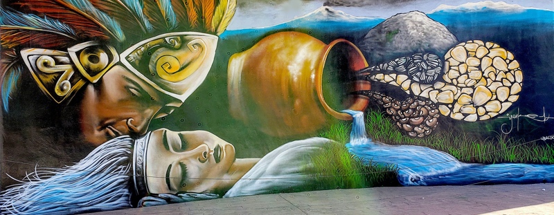
After saying his goodbyes, he kneels by her grave. During the night, gods covered both bodies with snow, turning them into mountains. Iztaccíhuatl is the dormant volcano and its four snow-capped peaks depict the head, chest, knees and feet of a sleeping female. Popocatépetl is the most active volcano in Mexico, raining fire in rage at the loss of his beloved. Since the arrival on the Spanish in 1519, it have had more than 15 major eruptions.

Iztaccíhuatl is the third, while Popocatépetl is the second, highest peak in Mexico. They are called twins as they are connected. The dangerous pass between them is how Hernan Cortes and his men sneaked into the Valley of Mexico in 1519, while trying to avoid Aztec warriors.

Valley of Mexico from Santa Isabel Mountain Range by José María Velasco, 1875
via Wikipedia
Quest #2: Where is the artist's house? While the Museo Nacional de Arte in Mexico City, locate the paining above. Can you find the contours of Mexico City by two towers of its Cathedral? Now, follow the ancient Aztec causeway or raised road to the Basilica to the Virgin Guadalupe, one of the greatest spiritual places in Mexico. What geological formation the Basilica is on? The artist’s home at the foot of it.
If you find my work worthwhile,
drop me a few
🪙🪙🪙

Venmo Me
payment wallet link


It will allow me to keep writing content like this!

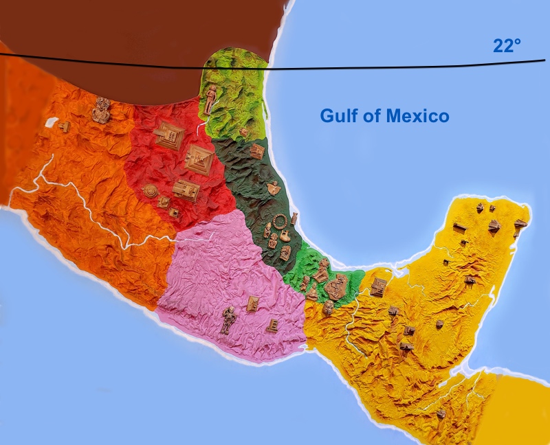
Humans were always attracted to the valley due to its abundance of water, fish and game, mild climate and large territory suited for growing food. Inhabited for at least 12,000 years, the valley was a center of many early Mesoamerican cultures, including the ones we now know as

  • the Builders of Teothihuacan (who lived 2000 years ago),
  • the Toltec (who lived 1000 years ago), and
  • the Aztec (who lived 500 years ago).
Hacienda de San Antonio Coapa by José María Velasco, via Wikipedia
Quest #3: Look for more landscapes of the Valley of Mexico. Can you find any paintings of the Italian artist Eugenio Landesio? He was Velasco professor in the Royal Academy of San Carlos.
Quest #4: (Bonus) Visit the Antigua Academia de San Carlos. It is a beautiful building and good art museum.

Do you like my posts? What until you see my quests! If you ever decide to visit Acadia National Park, check out my book available on Amazon as paperback and Kindle editions. Buy a book, change a life! Thank you for your support and patronage.

Copyright © 2022 by E.Gra. Unless otherwise noted, all rights reserved. Unless otherwise indicated, no part of this work may be reproduced, or transmitted in any form or by any means without the author’s prior written consent.

Research◇1. Mexico Routes

Mexico is pretty big, in fact it is the World’s 13th-largest country by area. It consists of 32 states. Here, I will teach you how to to choose what places to visit in Mexico and when. And at the end, I will share a 6 month Perfect Weather Roadmap in Mexico. The roadmap lets you have the maximum flexibly while traveling, as it is not limiting you to only one route. Instead, it offers multiple choices, allowing you to be your own travel agent.

If you find my work worthwhile,
drop me a few
🪙🪙🪙

Venmo Me
payment wallet link


It will allow me to keep writing content like this!

First, we looked at the climate.

While looking on the map, we noticed how much of Mexico territory is actually a harsh desert. Ouch!

Desert-like states in the north, besides California, New Mexico and Texas that are now part of the United States, were always scarcely inhabited. Could it be the reason why American Army had no trouble marching to Mexico City during Mexican-American War of 1846-1848?

JavierRA, via Wikimedia Commons

Mexico climate and landscape is desert-like in the north, tropic-like in the south and mild and wonderful in-between. This “in-between” is the true heartland of Mexico with it’s perfect weather, crazy history, mind-bending archeology and colorful traditions. It might come as a surprise, but it is mostly “in-between” is where ancient civilizations rose and fell.

Well, the 22 degree parallel seems as an agreed upon orienteer by many published travelers for separating frigid territories to the north. Removing the states above that line alone cuts the state count almost in half.

Then, we looked at the country’s crime rates.

Is Mexico safe? Mexico territory is divided into 32 states. Some states are safer to visit than the others. Each state safety level is directly related to the prosperity level of its population or the lack of it. Poverty pushes desperate people to become worse versions of themselves. Traveling through a poor state is NOT fun!

We visited Travel.State.Gov for the current travel advisory for Mexico and removed Colima, Guerrero, Michoacan states from our already shortened list.

Now, we chose cities.

Ok, after we selected potential states to visit, we were ready to look at the city level for each state. Also, while traveling, we want to include an occasional visit to a beach. So, whenever possible, we added some beach towns into the list of cities to explore.

StateCities to start with for state exploration
1. JaliscoGuadalajara – the second largest city in Mexico
Puerto Vallarta – a beach resort town
2. GuanajuatoGuanajuato
San Miguel de Allende
3. QuerétaroQuerétaro
4. HidalgoPachuca
5. San Luis PotosiSan Luis
6. VeracruzVeracruz – a port and a beach city
Orizaba
Xalapa
7. TlaxcalaTlaxcala
8. PueblaPuebla
9. Mexico StateMexico City – the biggest city in both Americas!
Toluca – coolest of all due to altitude (freezing during winter nights)
10. MorelosCuernavaca
11. OaxacaOaxaca
Puerto Escondido – a beach resort town
12. ChiapasSan Cristóbal
13. YucatanMerida – almost a beach city, 30 miles to the nearest beach
14. Quintana RooCancun – a beach resort city
The list of best states to visit in Mexico and some cities to start with.

Look how many states in Mexico offer great adventures! You can stop here and explore any cities on the list and more, or you can get pickier and set some low temperature limit, as did we (in the next step).

Finally, we built our Perfect Weather Roadmap.

We were planning on staying in Mexico for about 6 month during the winter of 2021-2022. Because it was the coldest part of the year, we ignored records on high temperatures. Even the hottest places in Mexico were at their mildest in winters. Instead, we would prefer not to get too cold. So, we set ourselves a limit on how cold the area can be during the night for us to enjoy it. We would comfortably stay above 50F (10C) for the nightly low temperatures.

We found wikipedia of great help, as it posted the temperature tables almost for all the cities on our list.

Source 1: World Meteorological Organization
Source 2: Servicio Meteorologico Nacional (temperature normals and extremes)

As an example, the table above is what wikipedia publish for Mexico City. We looked at Average Low, and added the city name (Mexico City) under each month it is above our limit of 50F (10C). In Mexico City case, the months were March and October. We also added the second half of February and the first half of November as well, expecting that this limit will still partially work. In total, Mexico city got 4 entries (in bold in the table below).

We repeated the process for every city on our list and, TA-DA, we got our Perfect Weather Roadmap!

Month/CitiesAll Month1-15 of the month15-30 of the month
OctoberGuadalajara
Querétaro
Guanajuato
San Miguel de Allende
Pachuca
San Luis
Tlaxcala
Puebla
Mexico City
Cuernavaca
San Cristóbal
Merida
Toluca
NovemberGuadalajara
Orizaba
Xalapa
Cuernavaca
Oaxaca
Merida
Guanajuato
San Miguel de Allende
Querétaro
San Luis
Puebla
Mexico City
DecemberGuadalajara
Orizaba
Xalapa
Cuernavaca
Oaxaca
Merida
Veracruz
Any Beach Town
JanuaryGuadalajara
Xalapa
Cuernavaca
Oaxaca
Merida
Veracruz
Any Beach Town
FebruaryGuadalajara
Orizaba
Xalapa
Cuernavaca
Merida
Veracruz
Any Beach Town
Querétaro
Mexico City
San Miguel de Allende
MarchMexico City
Guadalajara
San Miguel de Allende
Querétaro
Orizaba
Xalapa
Puebla
Merida
CuernavacaGuanajuato
San Luis
Toluca
Weather Roadmap

Now are were ready to comfortably explore Mexico by visiting any city of our choosing at its best time. And so can you! Enjoy!

Do you like my posts? What until you see my quests! If you ever decide to visit Acadia National Park, check out my book available on Amazon as paperback and Kindle editions. Buy a book, change a life! Thank you for your support and patronage.

Copyright © 2022 by E.Gra. Unless otherwise noted, all rights reserved. Unless otherwise indicated, no part of this work may be reproduced, or transmitted in any form or by any means without the author’s prior written consent.